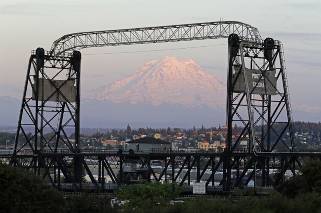
Back in the mid-’80s, I was at Ft. Lewis, Washington (now Joint Base Lewis-McChord) for a training course in those Pacific Northwest rain forests and mountains. We had one weekend off, and since three of my buddies and I had obviously not already spent enough time “humping the boonies,” as the saying goes, we decided on that Saturday to go hike nearby Mt. Rainier. Dominating the skyline in the south Seattle/Tacoma area, Mt. Rainier is a volcano, like the rather infamous Mt. St. Helens, although it was certainly inactive that fine, sunny Saturday. We didn’t hike to the top, but we did make it up to the tree line, and I took some impressive photos with a cheap 35mm pocket camera, most of which I’ve lost over the years.
I remember we stood there, admiring the vistas and talking about how puny the mountains can make a human feel. What we didn’t discuss was the fact that his noble peak is a volcano and what might happen were it to erupt. But now, vulcanologists — geologists who study volcanoes — are looking at what might happen in that event, and it’s not good.
“Mount Rainier keeps me up at night because it poses such a great threat to the surrounding communities. Tacoma and South Seattle are built on 100-foot-thick (30.5-meter) ancient mudflows from eruptions of Mount Rainier,” Jess Phoenix, a volcanologist and ambassador for the Union of Concerned Scientists, said on an episode of “Violent Earth With Liv Schreiber,” a CNN Original Series.
The sleeping giant’s destructive potential lies not with fiery flows of lava, which, in the event of an eruption, would be unlikely to extend more than a few miles beyond the boundary of Mount Rainier National Park in the Pacific Northwest. And the majority of volcanic ash would likely dissipate downwind to the east away from population centers, according to the US Geological Survey.
Instead, many scientists fear the prospect of a lahar — a swiftly moving slurry of water and volcanic rock originating from ice or snow rapidly melted by an eruption that picks up debris as it flows through valleys and drainage channels.
That lahar could very well hit Tacoma, where Ft. Lewis is, and south Seattle, both of which towns are built on massive lava flows from previous eruptions.
We’ve been fortunate here in the United States as far as major geological events occur. While people think a lot about the famous San Andreas and associated faults in California, which are strike/slip faults, there’s a much more dangerous possibility in the Pacific Northwest, in the Cascadia Subduction zone, where the Juan de Fuca oceanic tectonic plate is being slowly pushed under the North American continental plate; now and then (most recently around 1700) a major earthquake results. We’re talking Richter scale 9 quakes, with Pacific Ocean-spanning tsunamis. Much of the Pacific Northwest could be destroyed in such a quake and the resulting tsunami — we’re talking Seattle, Tacoma, Vancouver, and all the smaller towns near the coast — gone. And only moments notice to try to get out of the way.
See Related: Thai Town Tormented, Maddened by Marauding Wild Monkeys
SHOCKER: Body of Missing Indonesian Woman Found Inside Massive Python
The entire Pacific rim is geologically active; that’s why it’s often referred to as the Ring of Fire. Even here in the Great Land, we have volcanoes and earthquakes; now and then the normally quiescent Mt. Redoubt will burp out some ash, covering the Kenai Peninsula, normally just enough to be annoying. Mt. Rainier and the Cascadia subduction are all part of that.
Nature is big. Really, really big. Natural disasters on this scale can wipe out hundreds of years of human work (and humans themselves) in a moment. While there’s little point worrying over things we can’t change — and nothing humans can do can change events of this scale — it’s interesting, now and then, to contemplate events like this. It gives a fascinating perspective.